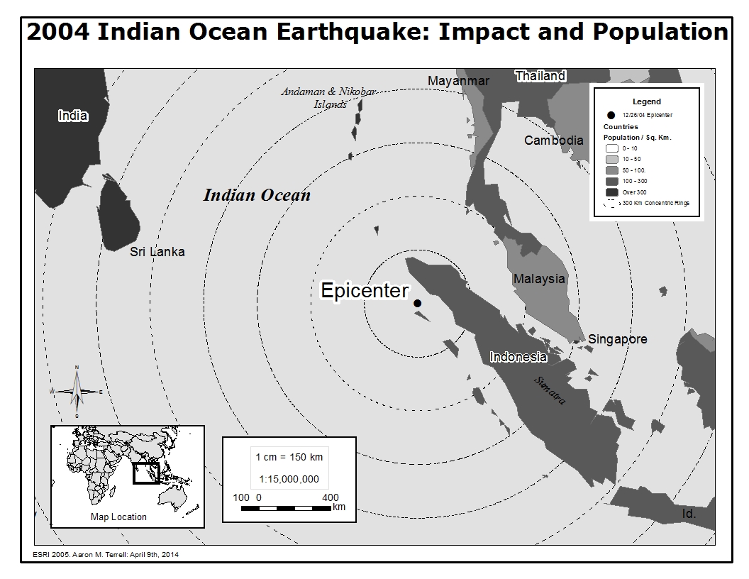
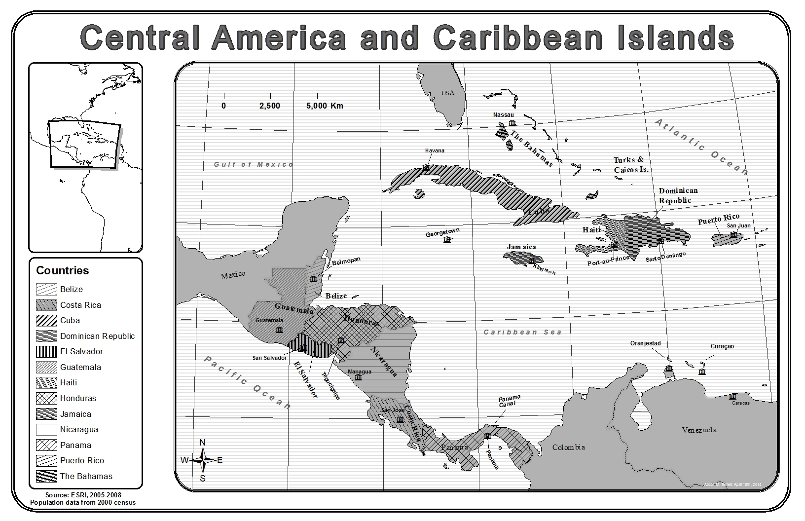
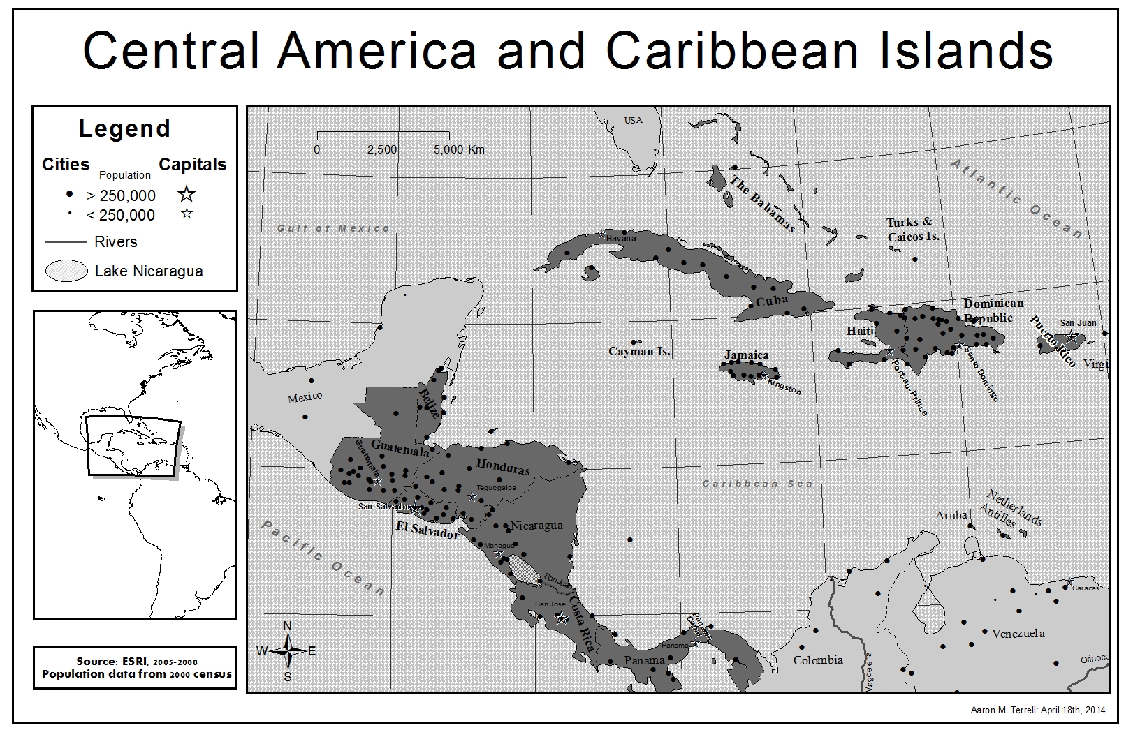
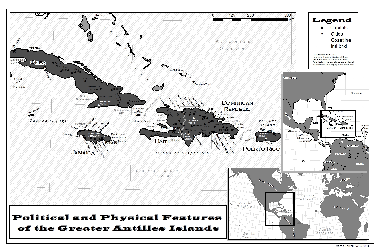
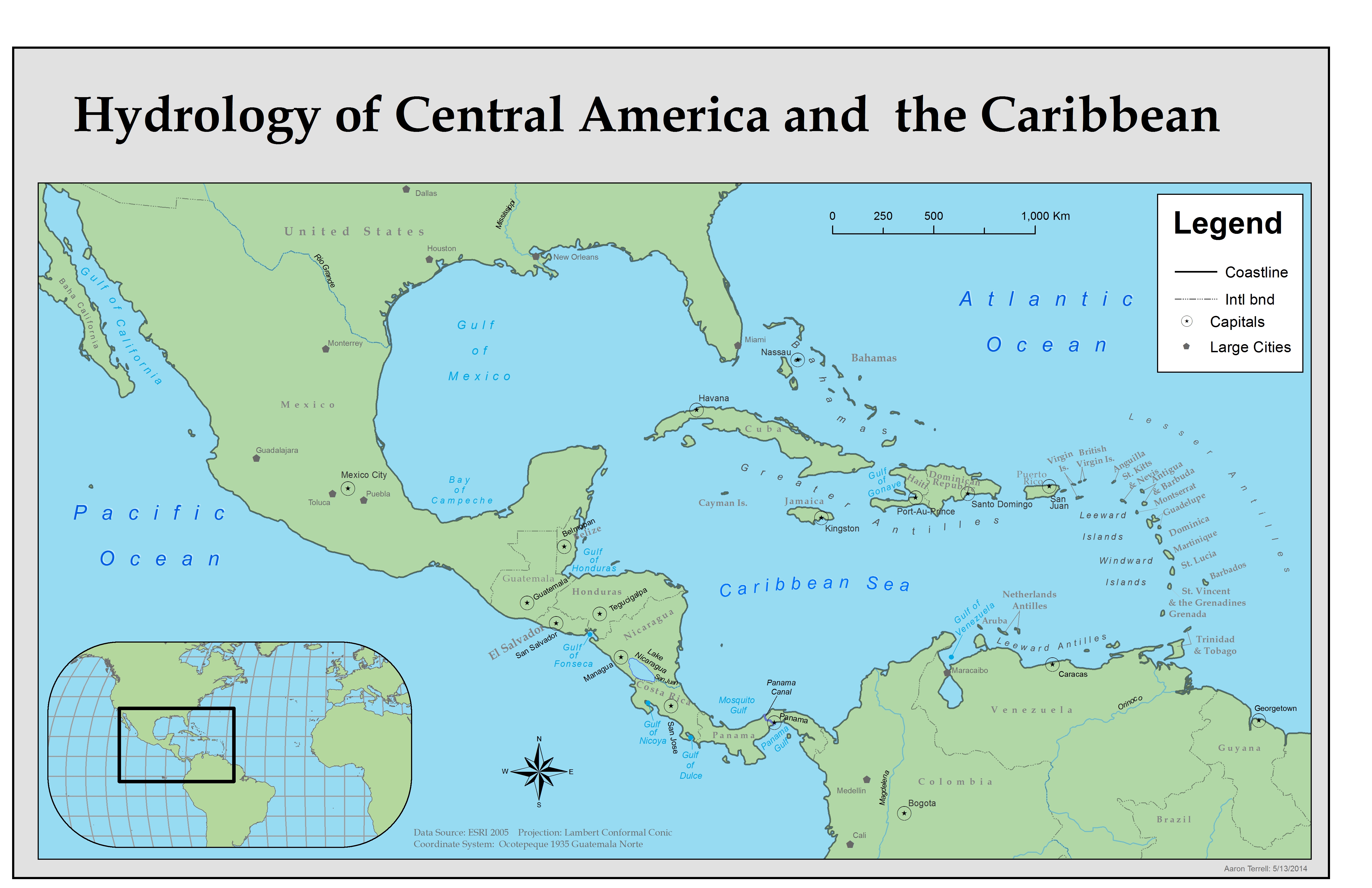
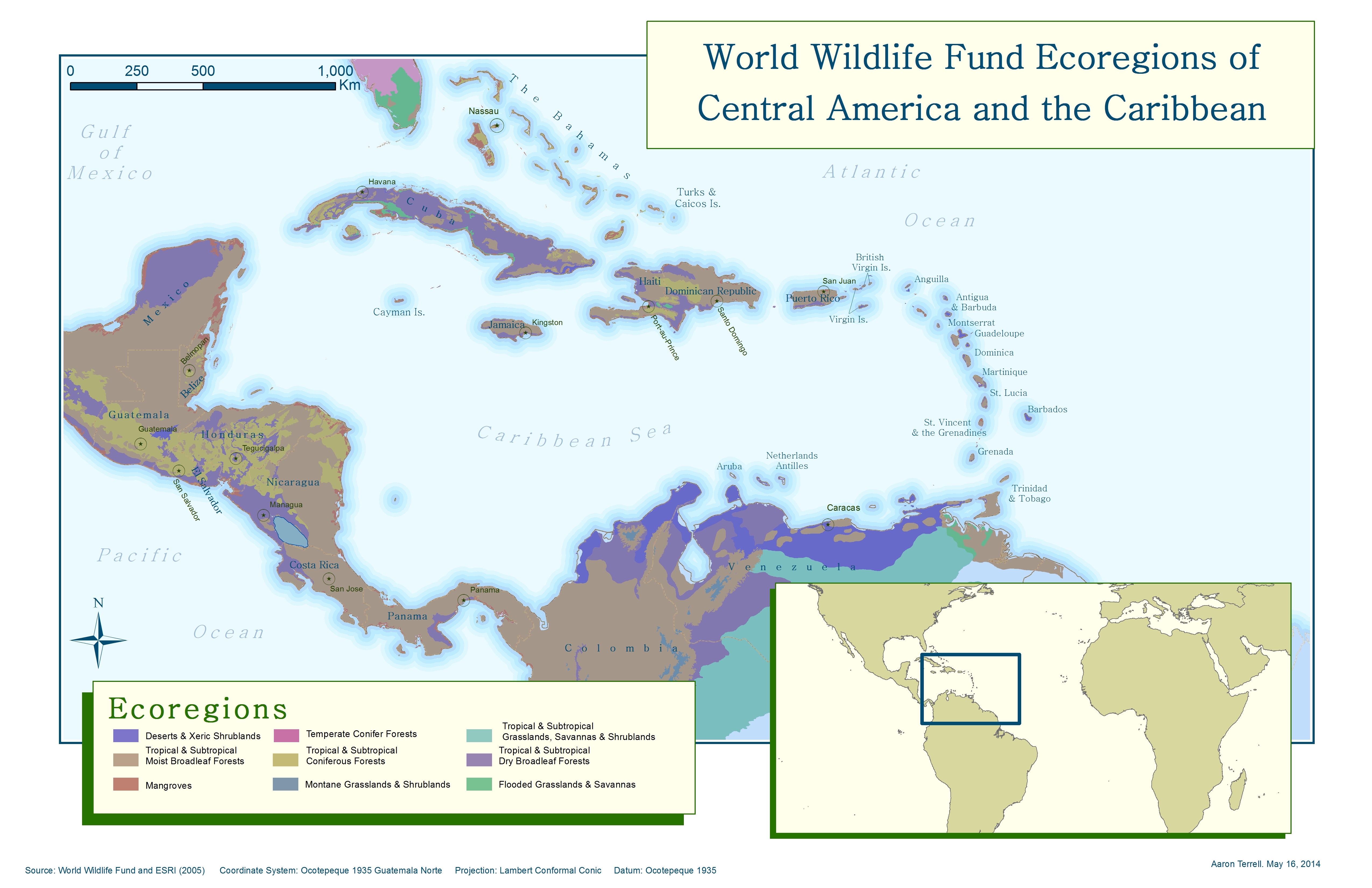
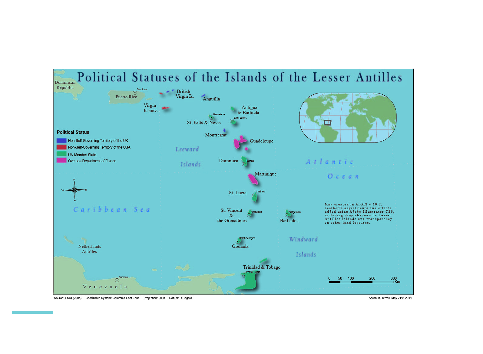
First cartography attempt. Created concentric rings demonstrating earthquake impact.Because we were encouraged to produce the first few maps in black and white, I gained experience using more subtle symbology techniques, such as lines and gradient fills. Experimented with different border options.For this map I converted features to graphics and became familiar with customizing legend items.Worked with custom labels – changing fonts, sizes, angles, leading, and character spacing. Also learned how to spline text. Also gained experience with multiple inset maps.Included colors as a labeling techniques.Used color to symbolize various ecoregions. Included nearshore buffers to demonstrate islands and give the impression water depth.I exported this map from ArcGIS into Adobe Illustrator where I was able to apply drop shadows to map features.